| [ Login ]/[ Register ] |
 Search ::
  My Data Basket ::
  Favorite/My Favorite :: Recent Changes :: :: Login Save in Data Basket ]
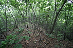
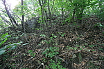
| Caption:彭家堡子长城2段 Photo Time:2007-06-24 08:16:07 Photo Contributor:辽宁省文物局 [Open in New Window] |
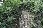
| Caption:彭家堡子长城2段 Photo Time:2007-06-24 08:44:05 Photo Contributor:辽宁省文物局 [Open in New Window] |
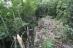
| Caption:彭家堡子长城2段 Photo Time:2007-06-24 08:44:32 Photo Contributor:辽宁省文物局 [Open in New Window] |
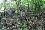
| Caption:彭家堡子长城2段 Photo Time:2007-06-24 07:36:00 Photo Contributor:辽宁省文物局 [Open in New Window] |
| Caption:彭家堡子长城2段 Photo Time:2007-06-24 07:36:09 Photo Contributor:辽宁省文物局 [Open in New Window] |