Official Name:
钻洞子堡ZuanDongZiBaoOur Name:
/
Other Name:
/
Period:明 / Ming Dynasty 1368~1644
Location: 宁夏回族自治区,吴忠市,青铜峡市,巴润别立镇巴彦朝格图嘎查东南15.22千米 / NingXiaHuiZuZiZhiQu,WuZhongShi,QingTongXiaShi,BaRunBieLiZhenBaYanChaoGeTuGaChaDongNan1522QianMi
[
Looking Local List]
Details:长城类别:关堡
经纬高度:东经:105° 46′ 北纬:38° 11′ 海拔:1336
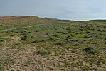
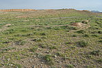
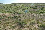
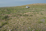
总体情况:墙体现已完全倒塌,由残存底部可辨整体格局。挖沟在内侧堆土为墙,沟宽2米,被泥沙掩盖,几乎与地表平齐,堆土墙坍塌,成土垄,宽1米-2米,高0.20米-0.40米。
附近遗存:
Type:堡 Fort
Protection Level:省保
Content:
Memo:
Other Records:
Distribution:
visit location in Tianditu Map[recommend] Distribution:
visit location in Tencent QQ Map Distribution:
visit location in Google MapDistribution:
visit location in Baidu MapNational ID:640381353102170005
The original number submitted by the local government :640381353102170002
(when the Great Wall is identified, the data whose code has been adjusted will display the original number submitted by the local government before revision, which can be used by the local cultural relics department when checking the local data.)
Action:[
 Save in Data Basket
 ]
Picture:
Click the thumbnail to view the Big Pic. Click the Big Pic to Hide the Big Pic![Caption:钻洞子堡
loading images --Please wait...]()
![Caption:钻洞子堡
loading images --Please wait...]()
![Caption:钻洞子堡
loading images --Please wait...]()
![Caption:钻洞子堡
loading images --Please wait...]() Photo Links
Photo Links:
 Search ::
  My Data Basket ::
  Favorite/My Favorite :: Recent Changes :: :: Login
 Save in Data Basket ]


