| [ Login ]/[ Register ] |
 Search ::
  My Data Basket ::
  Favorite/My Favorite :: Recent Changes :: :: Login Save in Data Basket ]
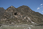
| Caption:南门峡闸门长城 Photo Time:2008-04-23 15:30:41 Photo Contributor:青海省文物局 [Open in New Window] |
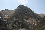
| Caption:南门峡闸门长城 Photo Time:2008-04-23 13:59:35 Photo Contributor:青海省文物局 [Open in New Window] |
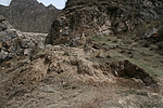
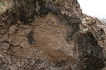
| Caption:南门峡闸门长城 Photo Time:2008-04-26 13:14:04 Photo Contributor:青海省文物局 [Open in New Window] |
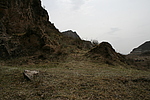
| Caption:南门峡闸门长城 Photo Time:2008-04-26 13:06:24 Photo Contributor:青海省文物局 [Open in New Window] |
| Caption:南门峡闸门长城 Photo Time:2008-04-26 13:06:42 Photo Contributor:青海省文物局 [Open in New Window] |