Official Name:
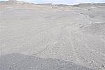
牛涎水墩消失长城NiuXianShuiDunXiaoShiChangChengOur Name:
/
Other Name:
/
Period:汉
/ Han Dynasty 206 B.C.~316A.D.
Location: 甘肃省,酒泉市,敦煌市,起点:阳关镇二墩村西北50千米止点:阳关镇二墩村西北52千米 / GanSuSheng,JiuQuanShi,DunHuangShi,QiDianYangGuanZhenErDunCunXiBei50QianMiZhiDianYangGuanZhenErDunCunXiBei52QianMi
[
Looking Local List]
Details:长城类别:墙体
起点经纬高度:东经:093° 35′ 北纬:40° 18′ 海拔:989
终点经纬高度:东经:093° 31′ 北纬:40° 17′ 海拔:995
墙体走向:该段墙体依据显明燧墩长城止点和牛涎水墩长城起点走向判断,总体走向为东北-西南。
墙体类别及构筑方式:无。
墙体类别:消失的长城
结构特点及构筑方式:该段墙体因春、秋两季潮水盐碱腐蚀、流沙掩埋,洪水冲毁,结构不清。
现状:
Type:消失的长城 Disappeared wall
Protection Level:
Content:
Memo:
Other Records:
Distribution:
visit location in Tianditu Map[recommend] Distribution:
visit location in Tencent QQ Map Distribution:
visit location in Google MapDistribution:
visit location in Baidu MapNational ID:620982382301040047
Action:[
 Save in Data Basket
 ]
Picture:
Click the thumbnail to view the Big Pic. Click the Big Pic to Hide the Big Pic![Caption:牛涎水墩消失长城
loading images --Please wait...]() Photo Links
Photo Links:
 Search ::
  My Data Basket ::
  Favorite/My Favorite :: Recent Changes :: :: Login
 Save in Data Basket ]