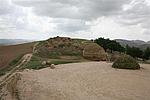
Official Name:
洪沟梁敌台HongGouLiangDiTaiOur Name:
/
Other Name:
/
Period:战国秦
/ Warring States 475~221 B.C.
Location: 甘肃省,庆阳市,华池县,乔川乡艾蒿掌行政村任台子自然村东北约1千米 / GanSuSheng,QingYangShi,HuaChiXian,QiaoChuanXiangAiZhangXingZhengCunRenTaiZiZiRanCunDongBeiYue1QianMi
[
Looking Local List]
Details:长城类别:单体建筑
经纬高度:东经:107° 35′ 北纬:36° 47′ 海拔:1661
建筑形式:
材料:黄土。
附近遗存:
Type:敌台 Defence Tower
Protection Level:
Content:
Memo:
Other Records:
Distribution:
visit location in Tianditu Map[recommend] Distribution:
visit location in Tencent QQ Map Distribution:
visit location in Google MapDistribution:
visit location in Baidu MapNational ID:621023352101020052
Action:[
 Save in Data Basket
 ]
Picture:
Click the thumbnail to view the Big Pic. Click the Big Pic to Hide the Big Pic![Caption:洪沟梁敌台
loading images --Please wait...]() Photo Links
Photo Links:
 Search ::
  My Data Basket ::
  Favorite/My Favorite :: Recent Changes :: :: Login
 Save in Data Basket ]