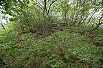
Official Name:
康家沟烽火台KangJiaGouFengHuoTaiOur Name:
/
Other Name:
/
Period:明 / Ming Dynasty 1368~1644
Location: 抚顺市,抚顺县,救兵乡康西村新堡自然村东北500米的康家沟大台子山顶 / FuShunShi,FuShunXian,JiuBingXiangKangXiCunXinBaoZiRanCunDongBei500MiDeKangJiaGouDaTaiZiShanDing
[
Looking Local List]
Details:长城类别:单体建筑
经纬高度:东经:124° 02′ 北纬:41° 43′ 海拔:302
建筑形式:整体呈馒首状,平面近圆形,剖面为梯形,原貌不清。
材料:土、石、砖。
附近遗存:西南距离房身后山烽火台2千米,东北距离孟家东山烽火台0.9千米。
Type:烽火台 Beacon Tower
Protection Level:无
Content:
Memo:
Other Records:
Distribution:
visit location in Tianditu Map[recommend] Distribution:
visit location in Tencent QQ Map Distribution:
visit location in Google MapDistribution:
visit location in Baidu MapNational ID:210421353201170072
Action:[
 Save in Data Basket
 ]
Picture:
Click the thumbnail to view the Big Pic. Click the Big Pic to Hide the Big Pic![Caption:康家沟烽火台
loading images --Please wait...]()
![Caption:康家沟烽火台
loading images --Please wait...]() Photo Links
Photo Links:
 Search ::
  My Data Basket ::
  Favorite/My Favorite :: Recent Changes :: :: Login
 Save in Data Basket ]
