| [ Login ]/[ Register ] |
 Search ::
  My Data Basket ::
  Favorite/My Favorite :: Recent Changes :: :: Login Save in Data Basket ]
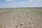
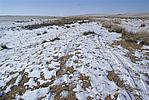
| Caption:乌兰敖包长城1段 Photo Contributor:内蒙古自治区文物局 [Open in New Window] |
| Caption:乌兰敖包长城1段 Photo Contributor:内蒙古自治区文物局 [Open in New Window] |
| Caption:乌兰敖包长城1段 Photo Contributor:内蒙古自治区文物局 [Open in New Window] |
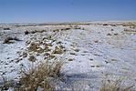
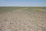
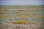
| Caption:呼和艾力更长城1段 Photo Contributor:内蒙古自治区文物局 [Open in New Window] |
| Caption:呼和艾力更长城1段 Photo Contributor:内蒙古自治区文物局 [Open in New Window] |
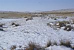
| Caption:呼和艾力更长城1段 Photo Contributor:内蒙古自治区文物局 [Open in New Window] |
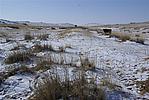
| Caption:呼和艾力更长城1段 Photo Contributor:内蒙古自治区文物局 [Open in New Window] |
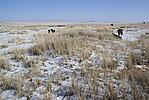
| Caption:呼和艾力更长城1段 Photo Contributor:内蒙古自治区文物局 [Open in New Window] |