| [ Login ]/[ Register ] |
 Search ::
  My Data Basket ::
  Favorite/My Favorite :: Recent Changes :: :: Login Save in Data Basket ]
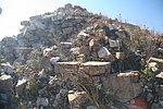
| Caption:石洞战台 Photo Time:2007-10-14 12:08:10 Photo Contributor:河北省文物局 [Open in New Window] |
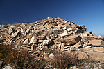
| Caption:石洞战台 Photo Time:2007-10-14 12:08:27 Photo Contributor:河北省文物局 [Open in New Window] |
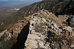
| Caption:石洞战台 Photo Time:2007-10-14 12:08:57 Photo Contributor:河北省文物局 [Open in New Window] |
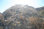
| Caption:石洞战台 Photo Time:2007-10-14 12:11:16 Photo Contributor:河北省文物局 [Open in New Window] |