| [ Login ]/[ Register ] |
 Search ::
  My Data Basket ::
  Favorite/My Favorite :: Recent Changes :: :: Login Save in Data Basket ]
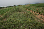
| Caption:六墩二边(长城) Photo Time:2008-07-11 07:59:03 Photo Contributor:山西省文物局 [Open in New Window] |
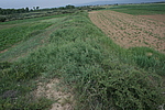
| Caption:六墩二边(长城) Photo Time:2008-07-11 08:01:31 Photo Contributor:山西省文物局 [Open in New Window] |
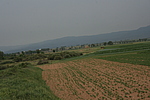
| Caption:六墩二边(长城) Photo Time:2008-07-11 08:03:19 Photo Contributor:山西省文物局 [Open in New Window] |
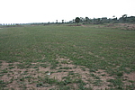
| Caption:六墩二边(长城) Photo Time:2008-07-11 08:22:22 Photo Contributor:山西省文物局 [Open in New Window] |