Official Name:
赵家营村-阳山村长城ZhaoJiaYingCunYangShanCunChangChengOur Name:
/
Other Name:
/
Period:战国秦
/ Warring States 475~221 B.C.
Location: 甘肃省,定西市,陇西县,起点:德兴镇赵家营村赵家营社西南650米处的毛家曳沟沟畔处止点:德兴镇阳山村南家坪社东北650米罗河西侧长城梁山坡上 / GanSuSheng,DingXiShi,LongXiXian,QiDianDeXingZhenZhaoJiaYingCunZhaoJiaYingSheXiNan650MiChuDeMaoJiaYeGouGouPanChuZhiDianDeXingZhenYangShanCunNanJiaPingSheDongBei650MiLuoHeXiCeChangChengLiangShanPoShang
[
Looking Local List]
Details:长城类别:墙体
起点经纬高度:东经:104° 26′ 北纬:35° 12′ 海拔:2213
终点经纬高度:东经:104° 25′ 北纬:35° 13′ 海拔:2116
墙体走向:
墙体类别:消失的长城
结构特点及构筑方式:无。不详。
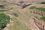
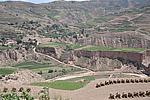
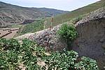
此段长城整体消失。该段长城起自第GPS193(起点),止于第GPS194(止点),全长1936米。
此段长城因东南-西北走向的毛家曳沟和东北-西南走向的罗河的发育、耕地利用和村庄建设等因素而整体消失。
现状:
Type:消失的长城 Disappeared wall
Protection Level:
Content:
Memo:
Other Records:
Distribution:
visit location in Tianditu Map[recommend] Distribution:
visit location in Tencent QQ Map Distribution:
visit location in Google MapDistribution:
visit location in Baidu MapNational ID:621122382301020025
Action:[
 Save in Data Basket
 ]
Picture:
Click the thumbnail to view the Big Pic. Click the Big Pic to Hide the Big Pic![Caption:赵家营村-阳山村长城
loading images --Please wait...]()
![Caption:赵家营村-阳山村长城
loading images --Please wait...]()
![Caption:赵家营村-阳山村长城
loading images --Please wait...]()
![Caption:赵家营村-阳山村长城
loading images --Please wait...]() Photo Links
Photo Links:
 Search ::
  My Data Basket ::
  Favorite/My Favorite :: Recent Changes :: :: Login
 Save in Data Basket ]


