Official Name:
新惠长城XinHuiChangChengOur Name:
/
Other Name:
/
Period:战国燕、秦 / Qin Dynasty 221~206 B.C.
Location: 内蒙古自治区,赤峰市,敖汉旗,起点:新惠镇簸箕沟村西南4.5千米止点:新惠镇下房申村东南0.37千米 / NeiMengGuZiZhiQu,ChiFengShi,AoHanQi,QiDianXinHuiZhenJiGouCunXiNan45QianMiZhiDianXinHuiZhenXiaFangShenCunDongNan037QianMi
[
Looking Local List]
Details:长城类别:墙体
起点经纬高度:东经:119° 59′ 北纬:42° 16′ 海拔:675
终点经纬高度:东经:119° 51′ 北纬:42° 19′ 海拔:595
墙体走向:
墙体类别:消失的长城
结构特点及构筑方式:无。
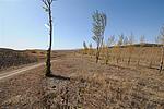
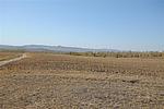
现状:该段墙体消失,总长12400米,地表墙体全部消失,已无遗迹可寻,由于该段长城所在范围是敖汉旗旗政府所在地,城镇建设时对长城墙体破坏最为严重,其它破坏原因较多,该段走向大体为东南-西北走向。
Type:消失的长城 Disappeared wall
Protection Level:无
Content:
Memo:
Other Records:
Distribution:
visit location in Tianditu Map[recommend] Distribution:
visit location in Tencent QQ Map Distribution:
visit location in Google MapDistribution:
visit location in Baidu MapNational ID:150430382301030024
Action:[
 Save in Data Basket
 ]
Picture:
Click the thumbnail to view the Big Pic. Click the Big Pic to Hide the Big Pic![Caption:新惠长城
loading images --Please wait...]()
![Caption:新惠长城
loading images --Please wait...]()
![Caption:新惠长城
loading images --Please wait...]()
![Caption:新惠长城
loading images --Please wait...]() Photo Links
Photo Links:
 Search ::
  My Data Basket ::
  Favorite/My Favorite :: Recent Changes :: :: Login
 Save in Data Basket ]


